Since the Baseline Map Query is flexible and easily customizable, the following example is a demonstration of how a Map query can be customized from baseline to provide valuable visual information.
The following visual map is based on a customized Baseline Map Query.
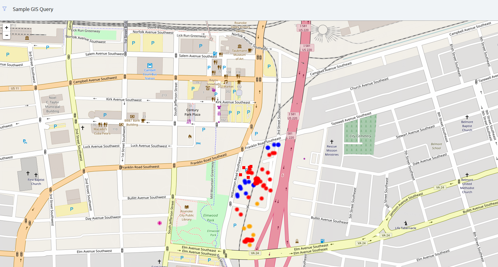
Six additional columns have been added to the five baseline columns, to create the following additions:
- The marker color indicates the Criticality level of the asset.
- The shape of the marker is determined by the Equipment Vendor.
- A hyperlink is added to the Location column that links to the asset in Record Manager.
- A hyperlink is added to the Equipment column that points to the asset in Asset Health Manager.
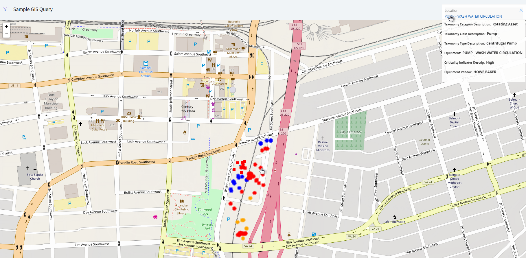
Interacting with the Map: Record Explorer
Supposed you were to select an asset on the Map, as shown in the following image:

On the upper-right corner of the map, you would see that the location PUMP - WASH WATER CIRCULATION had been selected.
If you were to select the Location link on the inset window, as shown in the following image...
...then, on a new page, the datasheet for the Functional Location would appear.
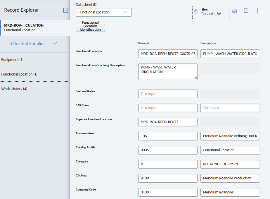
From here, you could continue working with your asset in Record Explorer as normal.
Interacting with the Map: Asset Health Indicator
As in the previous example, suppose you were to select an asset on the Map.
This time, if you were to select the Equipment link on the inset window...
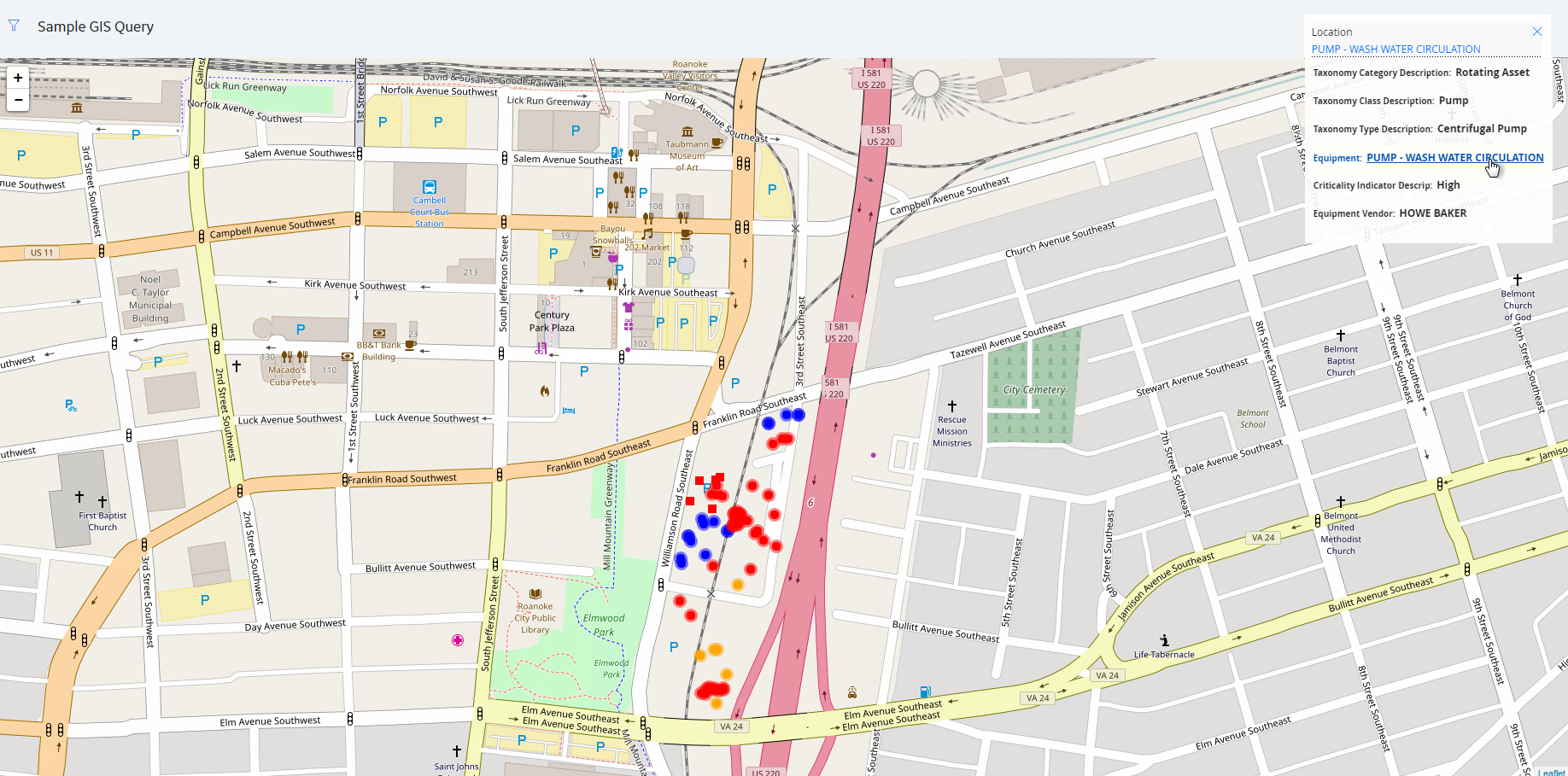
...then, on a new page, an Asset Health Summary would appear.

From here, you could continue working with your asset in Asset Health Management as normal.
Replicating this Example: Modifying the Baseline Maps Query in SQL
The following SQL code was used to create the Sample GIS Query described in this topic.
SELECT
[MI_FNCLOC00].ENTY_KEY, [MI_FNCLOC00].[MI_FNCLOC00_FNC_LOC_DESC_C] "Location",(? :gis :caption='format' :id=format :format) "Region",Decode([MI_EQUIP000].[MI_EQUIP000_CRITI_IND_DESC_C], 'High', 'Red', 'Med', 'Orange', 'Low', 'Blue', 'Black') "Color",Decode([MI_EQUIP000].[MI_EQUIP000_EQUIP_VNDR_C], 'FOSTER WHEELER', 'Square', 'Circle') "Marker",[MI_EQUIP000].[SC_EQUIP000_TAX_CATEG_DESC_C] "Taxonomy Category Description",[MI_EQUIP000].[SC_EQUIP000_TAX_CLASS_DESC_C] "Taxonomy Class Description",[MI_EQUIP000].[SC_EQUIP000_TAX_TYPE_DESC_C] "Taxonomy Type Description",[MI_EQUIP000].[MI_EQUIP000_EQUIP_SHRT_DESC_C] "Equipment",[MI_EQUIP000].[MI_EQUIP000_CRITI_IND_DESC_C] "Criticality Indicator Descrip",[MI_EQUIP000].[MI_EQUIP000_EQUIP_VNDR_C] "Equipment Vendor"
FROM
[MI_FNCLOC00]JOIN_SUCC [MI_EQUIP000] ON {MIR_FLHSEQ}JOIN MI_ENTY_GEO_DATA ON MI_ENTY_GEO_DATA.enty_key = [MI_FNCLOC00].ENTY_KEY
WHERE
([MI_FNCLOC00].ENTY_KEY IN ((? :gis :caption='bounding region' :id=region))AND [MI_EQUIP000].[SC_EQUIP000_TAX_CLASS_DESC_C] = 'Pump'AND [MI_EQUIP000].[MI_EQUIP000_EQUIP_VNDR_C] IS NOT NULL)